Mark Knopfler…Philadelphia And NYC Venues…Amazing!

The year was 1978, 41 years ago, that Mark Knopfler and the Dire Straits released the hit song “Sultans of Swing”. Now, Mark Knopfler is ending his touring career with his band and we got to see 2 of the shows including the final one at Madison Square Garden in NYC.

Philadelphia on August 19:

The Met Opera House had some of the best acoustics we have ever experienced. Beautiful venue too.
Pre-concert picture. Wonderful chandelier!
Check out the 11 musicians that play a combined 49 instruments.
Sailing to Philadephia!
His touring accommodations are a bit more luxurious than ours. Off to the west coast with him!

Madison Square Garden, NYC on September 25:

What many folks would call the most famous arena around.
Introducing Mark Knopfler!
We found Bonnie Raitt to be a wonderful musician in her own right.
We were moved by her lyrics and guitar playing.
Put the two of them on stage together and there is magic.
Sunset from the second level of the Garden.

While attending these concerts we took some time to check out Philly and NYC:

We could not believe that these young rebels took their off road machines to the streets of Philly…..The cops simply stood by and watched as nearly 100 of these rebels took over the streets with their wheelies and antics.
The Empire State Building. Still an architectural wonder to us.
Waiting patiently outside for the doors to open. A bit of time spent on the Penn Station steps doing on of the best pastimes… people watching.
Time Square was packed even though it was not New Years.
Grand Central at midnight. What a beautiful building.

If you want to see a nice concert in its entirety click on the youtube link:
https://www.youtube.com/watch?v=F37Q-1DSQ6E
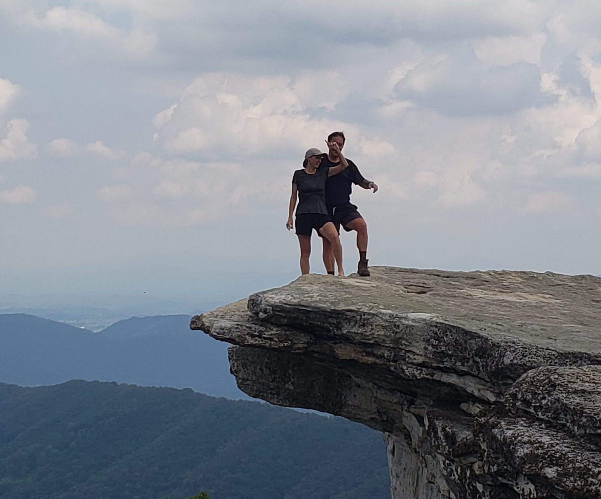
Mount Katahdin….The Official Northern Terminus Of The Appalachian Trail….Revisited!

The last time we hiked up Mount Katahdin (Baxter Mountain to some) was in late July of 2014 as we finished up the AT in the state of Maine. Having just actually completed the AT we figured an encore visit to this wonderful spot was worthy.

This picture was taken in July of 2014. The sign needs a bit of work eh?
September 2019. The sign has received a “fresh” coat of white paint but what about us??
The 5.2 miles to Baxter Peak (Katahdin) is one way. The round trip 10.4 miles took us over 8 hours to traverse.
Laurie is rarin’ to go.
The first mile was relatively easy and quick. The falls were amazing this late summer day:
Our first of many fabulous views.
With the terrain still not too tough, Laurie wonders…”what ahhhh keptcha Doc”.
A nice couple took our picture before the proverbial shit hit the fan.
A well placed stone here and there helped us climb up. The white blazes on the rocks is comfort for those folks ending their thru hike on the AT. They have already followed about 2185 miles worth of white blazes.
Laurie figured out the best line to climb the boulders and shared her new knowledge with me.
Not sure how to get my foot up to the rebar foothold??
Made it….just barely. At least it is only a 10 foot drop to the ground if I slipped here.
Maine’s version of “welcome to the alpine zone”.

The hike along the tableland was much easier but it was very windy. Windy enough to play havoc with your attempts to put your foot on the next boulder. Check out the video of clouds being formed along the ridgeline.

The famous author HD Thoreau found this place to be inspiring so they named a spring after him near the summit. The spring is not really usable as a water source at this point but it probably once was.
Only 3.4 miles of downhill boulder and cliff climbing to find our truck waiting for us.

We found such a nice spot to call home for our journey up Mount Katahdin that we have to share a few pics of the journey to the deep Maine Woods and the spot, Abol Bridge Campground.

Does this road actually lead anywhere?
At least the beaver population in Maine has a lot of playground space!
Gotta love the signage on the Golden Road. Yes, that is the name of the major road that travels north in Maine.
The weather looks iffy but what a gorgeous inlet off the river.
Our view for a few days.

New Hampshire’s 4000 Footers…Mount Jefferson And Mount Clay.

Goal driven folks we are why not bite off the New Hampshire 4000 foot peaks over the next number of years? We have already hike many of them over the years but we are finding that there are soooooo many ways to hike up the same mountain that no repeat hike is boring.

Caps Ridge Trailhead nice and early in the morning. Anyone seeing premature Fall colors in the pic?
The first view of “almost the summit of Mount Jefferson in the early morning clouds. Hopefully view will open up by the time I reach treeline.
Views of the valley below.
Not the smoothest of trails to walk over but so much fun!
There is the first of the “above treeline” cairns to show me the right path to follow. Without them these summits are simply piles of granite boulders.
Less than a half mile to go!
This is the summit stone for Mount Jefferson at 5,712 feet above sea level. Fairly non-descript I would say. Pretty sure nature did not place that triangular stone there. Does that mean it does not count when the USGS folks come up to measure the height of the mountain?
The happy peak bagger. Off to find Mount Clay.
This area is called “Monticello Lawn” as it is in Jefferson’s front yard!
The Gulfside Trail is also the Appalachian Trail at this point.
4000 footer number 2 is conquered. View of the summit of Mount Washington from the summit of Mount Clay at 5,533 feet above sea level.

A quick bit of history: Mount Clay is not named after a president but after a prominent US Secretary of State in the early 1800s. In 2003 the state of New Hampshire officially changed its name to Mount Reagan to honor the former president. As the White Mountains are actually part of a National Forest the Federal Government does not, as of yet, recognize this change of name.

A view of the auto road up Mount Washington from the summit of Mount Clay. Wish we could still ride a bike up that.
The summit of Mount Washington with the cog railway approaching it.
The cog trains used to all be coal fired but environmental worries caused a switch to bio-diesel fuel. Once a day they rev up the old coal fired engine for a trip. You can see the concern!!
A view of the southern end of what is called the Presidential Traverse through the White Mountains. The Appalachian Trail follows this route. Amazing.
A fabulous view of the ridge the Jewel Trail follows. It will take me to the parking area where we left the scooter earlier in the day.
Back to the standard version of a beautiful hike as I near the end.
The saviour. Back to the Bullet for a well deserved dinner!

Up And Over The Tallest Mountain In The Northeast…Mount Washington Via The Ammonoosuc Ravine Trail And Lions Head.

The 22nd annual edition of the “You and Me Makes We” picture at the Gem Pool. I think we are aging a bit more gracefully than the poor little pine tree next to us.
The absolutely fantastic Gem Pool on Mount Washington.

Once a year Laurie and I journey up to the Gem Pool about 1.5 miles up the Ammonoosuc Ravine Trail on Mount Washington. While there we have our picture taken next to the same tiny pine tree so we can track how it (and we) age. Most of the time we continue on up the trail to the Lakes of the Clouds hut for a warm bowl of soup before heading down the other side on Tuckerman’s Ravine Trail. This time we chose to head up to the summit of Mount Washington. We also chose to journey down Lion’s Head Trail for something different. Awesome hike and views.

Close to the headwaters of the mighty Ammonoosuc River. It eventually empties into the Connecticut River that flows down the NH/VT border.
Laurie is awaiting our annual adventure.
Sounds harmless that a place offers lodging and meals only 2.1 miles up the trail? A very hard 2.1 miles and the lodging is bunk style with many strangers snoring next to you. The fee…about $150 per night per person.
A slightly different type of roadside memorial for this poor Dartmouth Outing Club chap who died of exposure in early December 1928. Not our vision of a good way to go.
One of the many rock hops we needed to perform to get to the other side of the Ammonoosuc.
A surprisingly sturdy bridge. No slipping!
Much of the trail to the hut is on slanted slabs of granite. Surprisingly non too slippery, even when wet.
Not part of the trail but a cool set of waterfalls nonetheless.
The summit is in the clouds as usual. We will soon join the party at tree line.
Each fragile plant in the Alpine Zone can grow only a few centimeters per year due to the harsh climate. The highest recorded temperature on the summit is 72 degrees.
Not sure how many of those pine cones will successfully become a new pine tree?
What a gorgeous trail!!

Instead of a video I tried to put a good rock scramble into a gallery here. I think the video take is probably better but….

One final rock scramble to reach the hut and a much deserved bowl of soup.
What a great space to sit and contemplate life.
Found one of our entries in the log book at Lakes of the Clouds. Excellent memories of a past trip through the area.
One of the two lakes that lend themselves to the name of the hut Lakes of the Clouds.
Here is the other lake “in the clouds” today.
We say goodbye to the hut for another year on our way up to the summit of Mt. Washington 1.4 miles of rock away.
The rock piles called cairns help guide folks along the path when the fog is too thick…..which is almost all the time. Usually these cairns have a brightly colored rock set on top to help with visibility.

Views of some of the structures on the summit of Mount Washington. Almost always in the clouds all the buildings are actually chained to the ground to weather the constant winds that are normally in the 30-50 mph range with a world record 231 mph recorded years ago,

Dedicated to the New England Chapter of the 101st Mountain Division that had much to do with WWII around the Aleutian Islands.
As there is an auto road and cog railway shuttling folks to the summit we had to wait a few minutes to have our picture taken at the famous summit.
Back in the day (1979 and 1980) you were allowed to ride your bicycle up and down the auto road for free. I did so twice and lived to tell about it but some did not so they stopped allowing bicycles. Once a year they hold a charity bike race but even then, you cannot participate without finding a ride for you and your bike back down.
Check out the weathering on the Tuckerman’s sign. We chose this route, which intersects Lion’s Head before Hermit Lakes.

Check out some of the beautiful shots we got all day long walking down the “sunnier” side of the mountain:

The views of distant mountain chains is amazing.
A view of the Tuckerman’s Ravine Trail from Lion’s Head. It is a precariously dangerous trail that we chose to avoid this time around.
Could not imagine doing this without the help of these ladders.
Another waterfall (Cascade Cascade) greets us as we hike our final few steps toward our scooter at Joe Dodge Lodge.
One of our favorite places to stay in the area is Joe Dodge Lodge at the base of Tuckerman’s Ravine Trail.
Laurie is ready for the chilly 50 mile round the mountain scooter ride to wrap up our day.
At the end of a long day in the White Mountains why not top it off with a swig of “Granite State Vodka”? Each magnum bottle cost $5.99 with no tax!!

The Hardest Mile Of The Appalachian Trail Revisited 5 Years Later. The Mahoosuc Notch.

While hiking the state of New Hampshire on the AT we ran into (quite literally) a wall of granite boulders in the way of finishing up a hike. We learned that this one mile section of trail called the Mahoosuc Notch is considered the hardest and slowest mile of hiking on the entire trail. Check out some of the pics and videos we took on our revisitation of the Notch. Oh, it was raining this time so things were a bit slippier.

A pleasant path to begin our hike.
Just a precursor to the day’s boulder activities.
We actually remembered all the places on this signage. Maybe we are not losing our memories as we get older?
The first boulders of the Notch.
Not sure how I made it through there to get this picture?? A bit muddy after only a few boulder hops.
Laurie in action.
Waiting for Laurie to plan the next set of “moves” to get us closer to the other end of the Notch.
Maybe this is the way?
X marks the spot you say? Whatever that spot is?
Laurie is practicing her dance moves to the “Do the Rock Hop”
Wait for me!!
Might need to take the pack off for this one.
Glad the boulder had a “pocket” so my back could help hold it up.
A bit of butt sliding is necessary in the Notch.
Glad I lost some weight recently!
I would say I was a wee bit lost in the boulders but there was really only one path to take.
Made it by……just that much!
We did not think it wise to take the truck over this bridge so we added a mile or so to our planned hike. Safe and sound after our adventure so…..back to the Bullet.

The Mount Washington Hotel…A Fabulous Place To Stay And Explore.

After staying there while dating 21 years ago we decided that we would spend an evening at this fabulous hotel every decade. This year marked our 20th anniversary so…..

Our view as we walked up to check in.
Our view during our horse and buggy ride that evening.
What a construction undertaking!
1900 was the date this photo was snapped.
Saint was very friendly!
A beautiful evening for a ride with our shadows.

While listening to the clip clop of horse feet in the open air it was kind of cool to feel like we were living in the time of no automobiles for a while.
We had an absolutely wonderful, relaxing ride around the property.
Time to polish us up a wee bit for dinner in the grand dining room.
Complete with entertainment.
The room did not come furnished with the Bombay Sapphire but….
Slightly more relaxed apparel for breakfast in the dining room.

After a wonderful day with wonderful food we decided to take the tour the hotel offers at 10am before check out. What a fabulous place.

The main lobby.
A cozy room with fireplace to take the chill off the New Hampshire evenings.
This piano is still played by the occasional musician but otherwise it is off limits due to its quarter million dollar price tag. Yes it is a Steinway made specifically for the hotel.
The chandeliers and plaster work were amazing.
A slightly more rustic look with Bullwinkle keeping an eye on everyone.
Notice the last step is not scaled properly to the rest of the steps. This is because the religious craftsmen who created it believed that nothing should be perfect except for God himself.
The original phone for the hotel. Still in the same spot by the front desk.
The hotel is so large that it has its own zip code!
“The Cave” is a speakeasy that actually operated during prohibition. Very cool!
The original entrance to the Cave.
We are sure that the furnishings are a bit on the updated side but the atmosphere was awesome. The tables are made out of reclaimed heavy doors from the hotel.
An amazing piece of history here. This is the room that the IMF was established to help nations rebuild after WWII. The world evidently learned its lesson from how long it took the nations of the world to recoup after WWI.
This was the actual table that folks from 45 countries sat around way back in 1944 to hammer out the specifics of the IMF deal.
We will end the post with a picture of a picture of “The Old Man Of The Mountains in Franconia Ridge, NH. It crumbled and fell on May 3, 2003.

Our Sanctuary Away From Home…The White Mountains Of New Hampshire.

Each year we journey north to the White Mountains of New Hampshire. Ever since we started dating 22 years ago this has been our special, spiritual place to return to. Each year we have our picture taken on the Ammonoosuc Ravine Trail on the shores of the Gem Pool, either by a passer-by on the trail, or by using selfie mode and the timer on the camera. We also visit Mount Willard’s summit for a fine view of Crawford Notch as well as the Lower and Upper Falls of the Ammonoosuc River. This river starts atop Mount Washington at the Lakes of the Clouds and flows until it meets the Connecticut River that borders Vermont and New Hampshire.

Mount Washington generally has its summit in the clouds but not today. On the left you can see the path of the cog railway that takes visitors to the top via train.
The Mount Washington Hotel, one of the few remaining “Grand Hotels” of New England. We will be spending the night there as part of our 20th anniversary celebration.

The Lower Falls area of the Ammonoosuc River. One of our favorite spots in the world to relax to a drink and play a game of cards.
Laurie is not only basking in the glow of the falls but in the fact that she just won a few games of gin rummy.
There are no “no parking” signs in NH and outdoor enthusiasts take advantage of this and line Route 302 for miles on end just to get into the woods. There are so many different hikes in the area that there are actually very few hikers on each trail.
We happened to park right next to this lake. Gorgeous!
The Centennial Pool is about a half mile up the 1.6 mile Mount Willard ascent.
The Centennial Pool offers a nice spot for a picture, and a sip of water from the stream (after treating it of course).
The wind catches Laurie’s hair as she turns around to ask what I am doing? Taking a photo of absolute beauty…..Laurie and Crawford Notch with Route 302 running through it.
The “line” on the right is the path of the tourist train that takes folks for an out and back train ride through the notch. You can also watch the cars and bicyclists on Rt. 302. This is the view offered by a 1.6 mile hike up Mt. Willard!

Zip Lining And Repelling Down The Bretton Woods Ski Slopes.

We finally decided to try one of the zip line tours we have heard about for years. Neither of us are particularly scared of heights but we do have a healthy fear of stupidity…Hanging from a wire zipping 100 feet or more above the ground may qualify for stupidity but, hey, you know.

We figured out how to embed a video into the blog after this yearlong journey so simply click on the play button (white triangle) and watch our adventures.

Laurie is ready for adventure!
Roy wonders why hats/helmets are not made for such large heads?
Fabulous backdrop for this picture! The Mount Washington Hotel with the Presidential Range of the White Mountains behind it.
Training on how to zip along the cable. So smooth!
Would you step off the platform?
Training on how to repel. One of the most unnatural feelings I have ever had.
Mastered it!
The suspension bridges connecting an occasional pair of platforms were cool to walk across.
Laurie looks like a pro here.
Feeling like I might stick the landing?
Stuck it indeed!!

Hiking Vermont’s Highest Peak….Mount Mansfield.

So many years visiting Vermont and its Green Mountains but nary a trip to climb Vermont’s tallest peak. The time has come!

Very happy hikers!
Awesome CCC rock work done here in the culverts of the trail.
A peek at the views to come. Trail builders always have a sense of allure.
We did not explore it but you gotta love the name “Wampahoofus Trail”
A view of Lake Champlain in the distance. The Adirondacks are looming out there, too.
Mount Greylock has the slogan “Do The Rock Walk” to con hikers into staying off the fragile flora. Hopefully this sign has the same effect.
Notice the blaze on the rocks is now a white blaze. That signifies that we are on the Long Trail, the granddaddy of all long distance trails in our country. The blue blaze on the sign signifies a side trail, in this case the Maple Ridge Trail we had just traversed. The Long Trail tread also hosts the AT further south in Vermont but up here….it is king.
Gorgeous ridges in the background but the foreground has a standard turn blaze painted right on the rocks. Much of the trail was on the rocks and out of the woods.
The guide book warned us about two spots on the ascent along the Maple Ridge Trail. That small ledge was enough to shimmy along but with no hand holds, a slight misstep could send you for quite a fall.
The guide book also warned of this 6 foot deep and 4 foot wide crevasse. One long leap for us but one shorter step toward the goal of the summit.
The ridge we followed to reach the summit.

Some gorgeous summit views:

As is always the case, the downhill walk is the more demanding on these old knees.

Bicycling Up And Over Mount Greylock, Mass.

Over the years we have hiked up and down Mount Greylock a few times. It is the highest point of elevation in Massachusetts so it attracts hikers, bikers and highpointers. The highpointer club is for folks looking to summit all of the 50 states’ highest peaks. After all the hiking we have done, a nice bike ride seemed in order. We started right out of our campground and cycled up and over Greylock to North Adams before heading east to Williamstown and then south back to our campground to complete a 37 mile loop.

This monument on the summit memorializes the Commonwealth’s fallen soldiers from WWI. Extremely nicely done.
90 steps on this circular staircase.
View from the top of the memorial. Gorgeous.
The beginning of the 8 mile long uphill ride looks fairly harmless eh?
We had never actually seen a sign signifying a “hairpin turn”.
This is an Appalachian Trail crossing the summit road. I was not sure which way to go??

Great ride to the summit!

We took this picture at one of the scenic view pullouts. Nice day for a ride!
Beautiful accommodations at the summit!
Nicely done.
One of a few rests on the way up the 8 mile long hill.
An appropriately named road for the end of our ride.