As Close To Antarctica As You Can Get Around Here…Stewart Island And Its 12 Miles Of Bike Worthy Roads.

A nice bike ride along the islands 12 miles of road produced a ton of nice pictures like this one above.

The ferry terminal was only a mile from our temporary home so we walked and found it amusing that they labeled their train crossings with these sign instead of lights or gates.

As we waited to board our ferry we watched the onboard crane hoist the luggage onto the boat including this fully loaded touring bike. We wondered why they would not take the packs off and just hand them and the bike over the railing separately? Cool to watch folks using their toys anyway. Spoke to the older chap who it belonged to and he had cycled the length of the two islands and wanted to finish off at the southern tip to complete New Zealand. He was touring with an electric bike for the first time and said he enjoyed it and had no problems charging it.

Leaving the small port town of Bluff. Cool place with nice folks and some really good hiking and scenery. We will return later in the day.

Not a large ferry but for the hour long trip it ran us $110 NZ apiece each way or $70 US. Comfortable ride on this calm day.

We pulled in to the small and only town on the island called Oban. Quaint little fishing village with a nice array of eateries and accommodations.

A short little quarter mile walk to the “Electric Bike Depot” for our e-bike pick ups. Very accommodating place with free use of the helmet and panier for the day. There was even a helmet large enough to fit my immense noggin as they call it around here.

Made it to the other side of the island in a flash with our powered up bikes. Lots of steep and long hills but no issues today. Left the bikes unlocked, at the okay of the shop owner, and headed off for an hour long hike along the coast.

As New Zealand is fastidious about their public bathroom access there was one at the trailhead and that meant a series of pipes to dispose of the waste. There were four sewer caps and each had a different saying on it. We thought this one was appropriate for us.

The trees on the coast have to be extremely tough to survive the windy conditions. I thought I would help one of the trees out here by lending it a hand in its perpetual battle with the wind. The wind was actually no blowing this day and the trees simply stay in this configuration all the time. Cool.

Here are pictures of the “Anchorchain”. The top is on Stewart Island and the bottom in the town of Bluff on the mainland. Read the description in the middle as it is pretty cool.

Laurie is riding in circles waiting for me to take a picture so we can ride to get a good feed on (how they say go out to eat in NZ) back in town. The guy with the dog is also the owner of the bike shop. He was dropping off two bikes (unlocked of course) for two hikers that were finishing the hike around the island that takes three days to complete. Not sure what he charges to drop the bikes off but there are no Ubers here on the island.

Everyone we bumped into, a total of 10 maybe, said this fish and chips place was the best they have ever had. Supposedly the woman inside that owns it won a medal in Tae Kwan Do in one of the Olympics for New Zealand. Had a chat with the elder guy sitting there and almost prompted some fisticuffs with a young family who overheard his comments on the Maori people in politics. The mother of the family was the head instructor on Maori studies at the Christchurch University. Both sides had their points and were actually fairly polite but bluntly straight forward with their thoughts.

The big draw here is the blue cod. We had never had such a wonderful tasting fish anywhere. Similar to Atlantic cod but much creamier in texture. Evidently the blue cod is a deep and cold water fish only found off the coast of the south island in New Zealand and is actually blue in color. Oh my was it good.

The fish and chips actually came wrapped in newspaper like you read about in the old days.

Back on the bikes to check out the other side of the island. Came across this road sign to add to our collection of cool road side signs. Evidently there are quite a few penguins who call Stewart Island home. They feed during the day out at sea and come to sleep on land in the evening. We will not be here in the evening to see them in person, or is that in penguin?

Beautiful views of the different bays with their mini-islands and pleasure/fishing boats all over the island.

Nice park job was done with this boat eh?

Beautiful little cove for a swim if the water temperature was a bit warmer. Some folks were indeed swimming at the beach back in town but….

Beautiful old trees on the island. Some of these were decorated with old anchor buoys.

Back to the wharf to catch our ferry back to Bluff. Not really a large boat is it? There was a National Geographic cruise boat anchored nearby ferrying its 50 passengers back to it from a day of exploring the island. That is our type of cruise, only 50 folks.

On our way back to Bluff after a fantastic day of bike riding, hiking and blue cod!
Best Hike By A Dam Site!

We had no idea what we would be in for when we chose to drive an hour inland from the resort town of Twizel for a hike that Alltrails came up with. The past few attempts at Alltrails did not work out as they put us on private and gated property but this was a great one.

We knew right away that this would be a spectacular hike. The Belmore Dam is at the right and Lake Belmore to the left. The river coming out of the spillway had all sorts of boating activity on it. Water skiers and jet-skiers too.

Decided to sport the shades this day as the sun was intense. Lots of sun screen too. Trying to keep those pasty white arms and legs safe.

Spectacular ridge line trail this was. Not much trail maintenance needed here!

It sure would be cool to drive an off road vehicle on those roads cris-crossing the landscape. Our rental car contract tells us we must stay on paved roads. That has not happened but we do have our moral limits!

Same lake, different branch or arm of it. Love the little islands.

So nice of someone to put a bench for us at this wonderfully peaceful spot. We have learned during this trip to pack our books (and glasses) in case we find these types of spots and have the time to relax a bit.

We wondered about the engineers that planned the dam and their thoughts on exactly what pattern the lake shore would have after the river was dammed up. Note the lake takes “a right hand turn” and disappears into what looks like another lake in the distance.

The Clay Cliffs above was our bonus spot for the day today. Reminded us a bit of Bryce Canyon back home. Each day, almost without exception, we have encountered something of beauty that was not on the itinerary when leaving in the morning for a day trip. This place was down a washed out, rutted and dirt road about 6 miles from the highway. There was a sign noting its existence. The sign did not report that it was private property and you had to pay $5 to walk in from the carpark to see it. Once you got down to the spot you had to make the decision to see it to give the car a rest before bouncing all the way back to the road. There was also probably the largest house we have seen in New Zealand hidden off to the side of the cliffs. Guess business has been good over the years!

The Circle Track Hike. Only Way To Get There Is By Boat!

People in the know around here made us aware that this was some of the scenery used while filming the Fellowship of the Ring movie a few decades ago.

Off on another adventure! Picked up this small water taxi right around the corner from our airbnb and took the 5 minute ride to the other side of the river where there are many trails to explore but no roads. Only met 3 other people and they were passengers on our water taxi too. Life jackets must be worn at all times by everyone in New Zealand with heavy violation fines. Helmets on bicycles for all ages at all times too.

One of the more remote and unusual trail heads we have seen. Hope those stairs lead to a nice day of hiking.

As usual, New Zealand’s trails are called tracks and measured in time and not distance. At first we thought that rather odd as everyone hikes at a different pace but have realized that the times are pretty spot on. As we only had 3hr and 45 minutes to make it back to get picked up by the water taxi we figured on not lallygagging to much.

Most of the trees were beech trees. They have tiny little leaves that create a very comfortable walking tread. We touched that fungus on the dead beech above and it was really hard. No mushy fungus for the Kiwis.

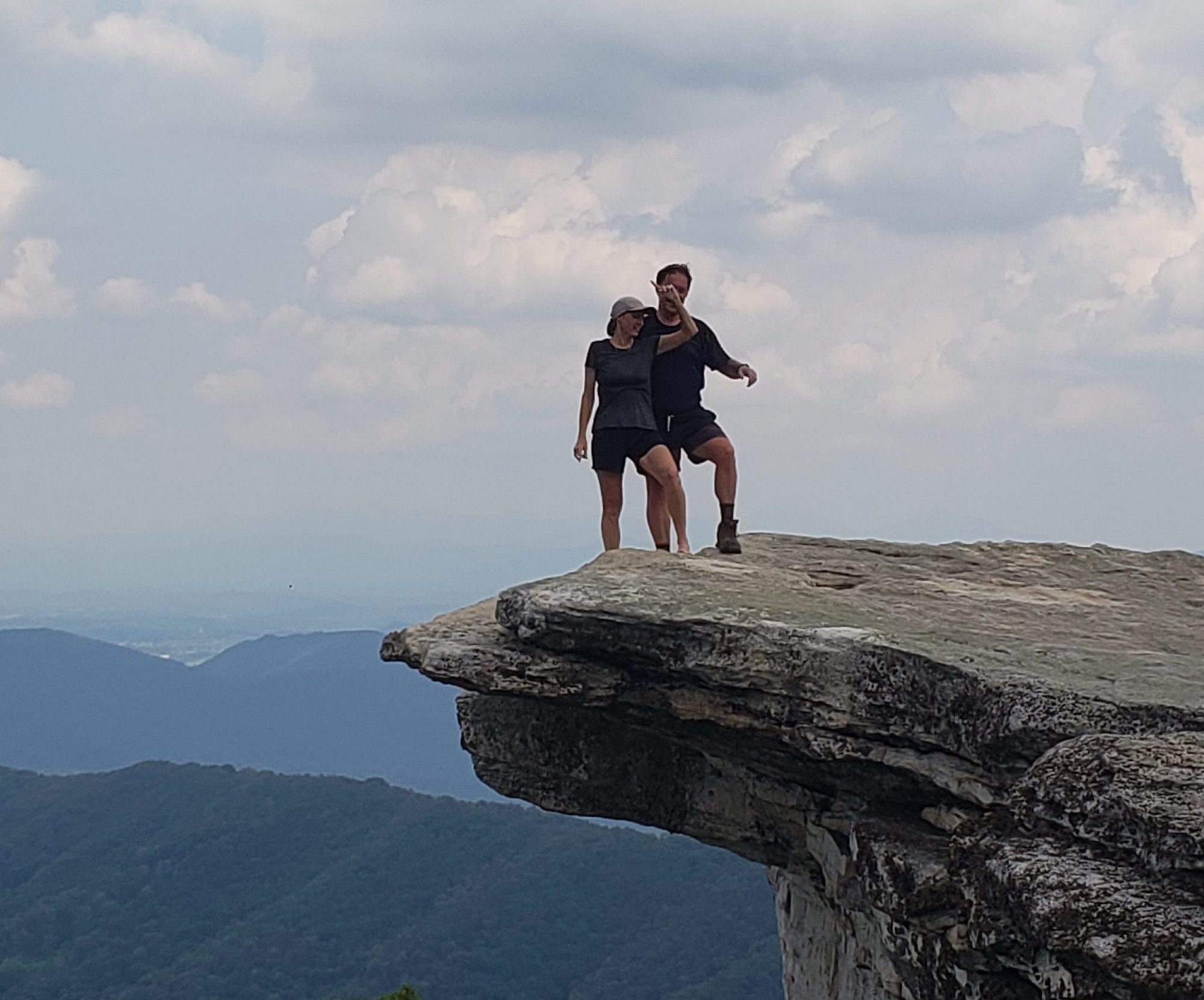
Laurie wanted a picture of me standing out on the edge but I was not so sure! How is that tree hanging on there? See the undercut? They say earthquakes are a common occurrence on the South Island. Just saying.

Found this fanny pack in the middle of the trail and knew just who it belonged to as there were only 3 people over here. One young lady was hiking a different track to the Hope Arm Hut and a young couple who were hiking our track. The bag contained a wallet, 2 passports, a phone and some other stuff. As we knew the girl was from Australia and the guy from Germany the outside of their passports matched that. Did not want to pry into someone else’s private stuff so that was all we needed to know. Question: Do you pick it up and try to bring it to them at the lookout spot a mile or two up the hill, or do you leave it figuring they would come back to find it? A tough call actually. We opted to leave it and take a pic with gps coordinates to let them know where it was if we ran across them. If not, the only way back across the river is the water taxi at 4pm so we would see them there. We did run into them on the way up the hill and they were thrilled we had seen their bag back down the hill.

Nature is so beautiful when left undisturbed!

This is how the trail maintainers for the DOC (Department of Conservation) mark the track’s endpoint. We went a bit further and found the views to be more spectacular.

Nice place to “drop pack” and enjoy the scenery with a bite of lunch!

When we stopped there to eat our lunch these two little guys joined us. Wonder why there were not skittish? No, we did not feed them.

Much of the Circle Track had us on the shores of Lake Manipouri on the way back to our “ride”. Nice to have hikes with differing scenery. The Southern Alps in the background are stunningly beautiful.

We said goodbye to the trail and our water taxi before heading back to our temporary home in the little town of Manipouri.

A Bicycle Ride into Queenstown…And A Bit of Bungy Jumping

Our sentiments exactly! NO WE did not do a bungy jump but got to watch a few folks take the plunge.

Sporting our e-bikes we were ready to tackle the 50km ride back to the bike shop in downtown Queenstown. We were transported by bus up to our starting point at the historic little town of Arrowtown. Bikes here in New Zealand are basically the same but one MAJOR difference is the front and rear brake handles are reversed. Very important going down hills or stopping on sandy surfaces as if you use the front brake strongly, you will flip over the handlebars.

Came across two of these cool suspension bridges on our route today. One of them we had to cross twice as it was on a detour to see the bungy jumping.

A view of our upcoming bridge we had to ride across. I suppose we could have walked it but that would be no fun.

Here is a view of the drop off from one of the bridges. No looking down while riding across!

Below are two videos to watch of our attempts to ride across each of the bridges:

Here is where we witnessed the jumping. This bridge also had fabulous views of the river and its gorge below.

Beautifully colored water in the river that flows into the giant Lake Wakatipu.

We saw many folks jump from the bridge but this was the only duo we saw. Hope they have bungies that will hold two folks at once.

Watch this guy jump and actually hit the water!

Once a jumper stops bouncing up and down they had to grab a pole extended by two guys on a raft that is tethered to the shore. Then they pull him in and ferry the jumper to shore where he has to climb many stairs to get back to bridge level. It only cost about $200 US to jump once. Yet another reason to just watch for free.

Fabulous sense of humor these folks in New Zealand have! Or are they being serious?

Appropriate signage for this place. They could have done a zip line version too as that was offered outside.

A good chunk of the bike path we followed meandered next to a nice river and then Lake Wakatipu. Only a km or so was actually on paved roads that were shared by cars.

I did not seem to bother these horse riders as they enjoyed this stretch of shared roadway.

Curious little fellow!

Cannot seem to get away from all the sheep here in New Zealand. I tried to converse with them to no avail.

We have ridden bikes across these cattle guards before but found the warning sign interesting. Usually signs are not put up until an accident of some sort happens to cause authorities to do so. Wonder what happened?

Made it here at last! This pizza joint had to be checked out for dinner after our tiring bike ride.

They even had gluten free and dairy free options in Hell. The decor was also rather hellish from the dummy at the pick up window above to caskets hanging from the ceiling above tables inside.

Check out some of the menu offerings.

I would feel like I was in hell if I ate the dessert “eat kinda ice cream”. Gotta love the kids menu option number 333.

Even their napkins had some great hellish artwork and gotta love the phone number too.

Just in case you wondered what a pizza in hell looks like. Love the customer comment number on the back of the box “how the hell was it?”

Mt. Cook And All of its Glaciers. A Wonder to Gawk at!

Driving toward the park from the small town of Twizel we got our first look at Mount Cook in the Mt. Cook National Park. The park is at the end of a dead end road, as most roads to cool things in New Zealand tend to be, and boasted many really nice 3 to 5 mile hikes.

Getting closer!

Time for hike number 1 to Kea Point. The 1 hr return means round trip. We have found that the times (they generally do not use distances) on their signs are fairly accurate for our pace. Would have thought we would be in better shape for hiking than the average person but we guess not in New Zealand.

That is a lake in the middle of the picture. It has a color of gray silt from the glacier runoff. Across the lake is the lateral moraine of one of the glaciers in the area. The glacier that left the moraine debris is not visible here as it has receded by 400 meters over the past few years.

Mueller Glacier is quickly disappearing. Amazing the amount of rock carving these ice giants do as they ebb and flow.

Hike number two was up to see the Tasman Glacier and Tasman Lake. On our way up the 300 foot of elevation gain we got a glimpse of the 3 “Blue Lakes”. Turns out they used to be blue before the melting of much of the glacier mass left them “high and dryer” so to speak. With little water left in them the algae took over and turned them green. Still pretty though.

Laurie looks out over Tasman Lake with its fabulous silty color. There was a small iceberg that had broken off the glacier but photos could not capture it. The small blip in the lake to the right of her head is actually a kayaker! Hope he/she does not flip as this was definitely a 5 out of 5 on the SSS because there is ice floating in that water. A reference for those of you that remember the Seinfeld “Shrinkage” episode about the scrotum shrinker scale. The Tasman Glacier is actually visible but it is covered in “dirt” so it does not look like ice. Its terminus is the flat line at the top of the lake.

Hike number three of the day up the Hooker Valley Track gave a different view of Mueller Lake and the lateral moraine of the Mueller Glacier. Unbelievably beautiful and peaceful to see. We would have loved to see this river at spring melt time.

Above is the suspension bridge we took the previous picture of. The signage on the bridge said “Maximum load limit is 20 people”. We counted more than that so we waited our turn patiently. There were three of these engineering marvels along this route.

Another fabulous view in the opposite direction of the valley formed by the glacier over the past 5 major ice ages on the planet.

On our way back “home” we ran into a few interesting things:

We have seen many long distance touring cyclists in New Zealand. Here is yet another example of having to bike down a long 50 mile road just to turn around and bike back out. No shoulders either! Notice the older one lane bridge. New Zealand has many of these where one side has a sign with a black arrow and the other with red. Red gets the right of way if two cars show up at the same time. That has only happened to us once in 7 weeks! Most drivers are very courteous and cautious toward the bikers but it only takes one.

We passed by a salmon farm and did a bit of research on how sustainable it is and what damage it does to the surrounding river/lakes. As the fish are all penned up in these “cages” they are constantly pooping into the surrounding waters causing what we feel is a big mess. They also do not get any exercise so they tend to be very fatty. Laurie found that out the hard way as she purchased, cooked and ate some only to feed the rest of it to a stray cat outside our place.

Back at our place we noticed that our neighbor had hung his sheep pelts in the far back yard to dry. That will be 25 million minus 2 sheep in New Zealand!

Fjordland National Park, A Glorious Day in Milford Sound

A trip to New Zealand would not be complete without checking out one of the fjords in Fjordland National Park. Milford Sound is supposedly the most spectacular of the 14 fjords in the park. We did not visit any of the others as this is the only one with a road to it. Doubtful Sound can be reached by a long boat ride a long bus trip and then the cruise on the sound for more than double the price.

We opted for a bus trip rather than drive the 2 hour approach road by ourselves. All we have spoken to recommend this as the approach road has the most head on accidents in the country. After you drive the perilously skinny, hilly, curvy road for over 2 hours then take your 2 hour cruise then try to drive the same road back to the town of Te Anau folks tend to be tired and drift into the other lane. The bus ride was spectacular as I finally got to relax and not do the driving. Check out the glass tops and windows with the views outside.

The bus stopped 4 times on the way in to allow us to stretch our legs and grab a few pictures like the one above. The bus driver was witty and humorous as most folks that deal with the public here are. His choice of music was also to our liking. He played 70s and 80s music that was right up our alley. His choice of places to stop and his commentary made the 3 hour trip about as fun as the cruise itself

After going through the almost mile long Homer Tunnel we stopped at this spot for a few minutes. Ain’t nature grand?

Above is the exit to the tunnel covered by an avalanche protector as they call it. Cannot imagine a machine boring through that mountain! There is construction going on to fortify the avalanche cover on both sides of the tunnel. Our driver asked us not to consider that a large earthquake is overdue in the region while we were in the tunnel.

Oh my! Back in the day this would have been a no brainer for us folks that enjoy a long hilly and remote ride. He rode the 60 miles to Milford before turning around and biking back. Crazy bastard. We passed him 4 hours later on our return trip still trying to make it,

Still not at the fjord and look at the fabulously colored and clear waters coming down the sides of the mountains.

Same stop for the bus but different waterfall. So cool, quite literally.

Finally on the cruise boat with a view of Mitre Peak, the parks tallest peak. We watched a video on Youtube of 3 friends that kayaked out to it and then walked up and down it before kayaking back to town. Crazy.

They call the forest in the park “catastrophe forests”. The catastrophe is that every now and again a tree comes uprooted at the top and causes a catastrophic avalanche of trees creating what you see above, They say it only takes about 120 years for it to regrow!

There are only 3 permanent waterfalls in Milford Sound. This was not one of them. It is a temporary one that only appears after some decent rain. No rain today but it has been raining a bit lately. So pretty.

This beauty is one of the permanent waterfalls. They say it is the source of the town’s drinking water as well as the generator of its electricity. 80% of New Zealand’s power is hydro-generated. Pretty good way to get your electric eh? The water comes directly from glacier melt so they say it has been locked up as ice for up to a million years.

A glacier in the middle of a rain forest?? Not many places this happens in the world.

These are New Zealand fur seals. Close to extinction a hundred years ago but after protection their numbers are coming back but nowhere near the 2 million that were here a century ago. These are adolescent males that got kicked out of their group, as per the captain of our ship. They enjoy it here at Seal Point (remember that New Zealand has very literal naming of things) as it is warm and more importantly, windy to keep the sand flies away. With all the travelers visiting New Zealand from around the world the sand flies are treated to an international buffet. So far we have been fortunate they haven’t feasted on us too much. These little bastards only exist on the west coast of the Southern Island.

Could not get over the beauty of the place here. Reminded us of a fjord we cruised in Newfoundland in 2007 called Western Brook. They were both very scenic and remote but this one takes the prize.

No cruise through a fjord would be complete without a roast beef sandwich and a local beer. Note the jacket in mid summer. Woke up to 38 degrees this morning but it was almost 70 by dinner time. It takes a long time for the intense sunlight to heat up the place but eventually it always does.

Our cruise ship turned around when we reached the open Tasman Sea. Last time we saw this we were at Cape Reinga, the northern most point in New Zealand.

Leaving this post with a video of the most cool falls of the trip. Legend has it that if your are sprayed by the mist of this waterfall you will wake up tomorrow morning looking ten years younger. We will see in the morning? A bit like the Niagara Falls back in the States but not as much mist.

Fabulous Ocean Scenery Near Ohope, New Zealand

A view of the Pacific from the back porch of our accommodations. So nice to be able to get out of bed and stroll to the beach. Oh, the beach does not have too many folks here either!

The ocean was not too angry this foggy morning. So peaceful.

During our afternoon stroll we watched as this “poor lifeguard” had to come out of his shack and get the lifeboat ready as a father and son decided to go for a swim between the flags that beaches set up as “safe zones” to swim. Maybe the guard enjoyed all the action?

A picture of driftwood you ask? Well, we think their name for it is cool: “Slash”. No fires are allowed in most of New Zealand, even on the beach. Killjoys!

On our way down to the beach at Otarawairere Bay We stopped to admire this huge fern tree with the largest fiddlehead we have ever seen. They don’t grow ferns like this back in the States.

This picturesque spot was not very crowded as the 1/2 mile walk down from the cute neighborhood had an elevation loss/gain of 300 feet or 30 stories. No escalators yet here in Kiwiland.

As the tide was low, Laurie found that continuing our walk was not only possible, but very scenic.

Laurie uses this piece of slash to ford the mighty stream below her. The days of simply walking across the rivers in the backwoods of Maine are done for today. Note, I just jumped across to avoid wet feet. Not a good idea for an aging guy with a bad back!

We found that this portion of the beach was made up of a layer of crushed seashells. Very cool texture on the feet. Thought it would hurt but….not.

Talk about a tree “putting down roots”. Nature really is amazing!

Speaking of nature, check out this colony of baby snails. We assumed they were snails but regardless, there were many adult snails in the area that must have “created” them in spots that most shoes would not squish by mistake.

If you are wondering if I got splashed here, I did. Cool little hole in the rocks reminded us a bit of Thunderhole up in Acadia National Park on a much smaller level.

As we did not bring our climbing gear we figured this was the end of our hike for the day.

Off to a scenic viewpoint that was accessible by car. Here is one of the many times we yearned for our tent back home as it would be fabulous to wake up to this view in the morning.

The viewpoint had views of two different towns in the distance. This is the town of Whakapapa. Remember that wh is pronounced “F” in Maori so don’t say it out loud!

This is the town of Ohope. We could not make out our house but knew where it was by the landmarks we recognized on the beach.

Interesting Maori artwork situated up high here taking in the views.

We took a walk through what folks around here call “the bush” to avoid a golf course (nice spot for a course by the way) and find a deserted stretch of beach out to Ohope Heads. Heads are the “end of the road” so to speak on a peninsula. The area above the high tide mark was roped off and signed with the above.

These birds called Variable Oystercatchers were fierce defenders of their young chicks. The little bastards came down to the water, out of the SAFE ZONE set up for THEM, and attacked us quite viscously. We tried reasoning with them that we were in our safe zone but to no avail.

More artwork here in the Whakapapa Heads area. Supposed to have something to do with protecting the sailors navigating the waters here.

Here is a video of the turbulent waters around the inlet to the bay. Our Airbnb host told us that not too long ago he watched 5 different boats capsize right here during the same stretch of bad weather. He said that he and others had to help rescue all the folks that were thrown into the water.

A Kayak Adventure on Lake Taupo Followed By a Cool Hike:

We generally try to avoid touristy towns, especially when it is “in season” like here but we heard Lake Taupo (pronounced like Toypo) had to be seen. We located a kayak hire (they call rentals hires out here) in the cool little spot called Acacia Bay. We opted for a tandem kayak because, why not? The tandem bike has taken us many cool places so maybe this kayak would too.

The water and the sky were such fascinating hues of blue. Crystal clear water too. There were other boaters around but not too many in this secluded little cove.

Still wearing the ubiquitous bucket hats to protect the noggin and neck, never mind our lips as mine are quite sun burnt at this point. New Zealand demands that all folks, no matter how old, must have their life jackets on at all times. Big fines if caught. Being in a tandem kayak makes some picture taking easier, but can’t really get good pics of the boat itself.

We snuck up on these black swans searching for their lunch. Cool to watch the birds dive below the surface and reappear elsewhere. Boy was the water clear.

We have found that most houses in the country of New Zealand are very modest in size and appearance. Bet the houses on the hill with a lake view sell for a pretty penny though.

We paddled down to another cove and found this “Holiday Park” where freedom camping is a thing. Many tourists rent camper vans to explore the islands. With the price of gas at around $8 per gallon US, as well as our aging bodies do not want to sleep in the back of a van with no bathroom either, we would watch others freedom camp and live it up a little ourselves. There aren’t many places that free camping isn’t allowed, but when it is not those spots are clearly marked.

Next up was a cool little 5km trek to see the Waitonga Falls. A hike here is called a trek and signage is usually in minutes “return”. Return means roundtrip. Took us a while to figure that out. On our way we had fabulous views of Mt. Ruapehu.. Not sure if there are any trails leading to its summit. An adventure for another day maybe?

A lot of treks in New Zealand are on these boardwalk type tracks. Keeps folks from running all over the place and destroying the native alpine flora. Not our favorite tread to walk on but we understand. Took lots of money and labor to put this 2 km of track in way back when.

Nice little alpine lakes where we rested and took in the view were dotted along the trail. Reminded us a bit of the Lakes Of The Clouds on the trail up Mt. Washington back home.

As it has been a dry summer so far around here the falls were “falling” a bit less. Waitonga Falls is over 39 meters high (about 125 feet) so still would not want to take a fall off that.

Laurie is being very patient with my picture taking but was champing at the bit to check out where the stream was leading.

Very peaceful little stream with no one but Charlie around to ruin the tranquil atmosphere. Charlie is a 70 something guy from the Lake Placid area back home. We ended up having him over for Christmas dinner as he was traveling alone. Nice guy!

A cat lover’s dream come true! Double fisted kitty purring kitty cats. They were well behaved for the most part but one time one of them took a good chunk of flesh out of the other when he/she felt attention from me was being hogged or stolen.

Katikati Bird Gardens and a Fabulous Cottage

Our fabulous little cottage that is actually in the sanctuary itself. Love the Maori art work statues welcoming us home.

Back deck where we had coffee in the mornings and dinner at night. Not only gorgeous but the New Zealand wild birds make the most tropical noises.

Double click above to see the 2 little guys in the tree talking with each other. Well, you can see them but their songs are amazing.

Our private entrance to the bird gardens as it is open to the public from 9-4 everyday.

After the damned rooster stopped crowing (5am sharp until 7am or so) we were surprised by a really loud noise on our roof. We found Mrs. Peacock prancing around up there. Not sure why but what a sight!

Each morning we had many visitors looking for a handout. We thought they were simply being friendly until we found out that visitors here are allowed, and encouraged, to feed them. The caretaker said we could feed them our remaining rolled oats. They loved them.

Each day we packed our lunch, our books (and freaking glasses…getting old has its drawbacks), water and rolled oats for a nice mile or two stroll around the 10 acre garden.

Below are a few pics of the gardens without the birds stealing the show. We are not into wandering botanical gardens or anything like that but we made an exception for this exceptional place.

No good bird garden would be complete if not for the neighboring cows. Fabulous!!

As a former teacher I am used to being ignored by uninterested students so this made me very happy. They were all very interested in the Pythagorean Theorem I was discussing. Or was it the rolled oats in my pocket?

So many birds, so little rolled oats. The male peacock rules the roost here. So much for the pecking order amongst chickens.

Around every corner we ran into a mother hen with 3 or 4 adorable little chicks. They could not have been but a few weeks old. As they are used to being fed by visitors, they were very interested in interacting with us. Their little peeps were wonderful.

The winner of the cutest bird family has to go to this mother duck and her three ducklings. Check out the video of them below by double clicking it:

Talk about a BAD hair day!!

We named our friend here Herman. He tagged along with us on our walks even if we were not feeding him. He found his mate after a while and we took a video of me feeding the two of them. Check it out below:

This was the nicest looking chicken of the place. Patient bird with us trying to orchestrate a nice picture before it ate its lunch.

Amazing how accurate these birds are with their pecking. Not once did they peck my fingers while I fed them.

Not sure what these little piggies of a bird species are but they did keep us company while we did some reading in the garden. Note, Herman is close by to protect us from these birds and the neighboring chickens.

My buddy here looks artificially large but the extinct, flightless bird called a Moa reached up to 10 feet tall and weight upwards of 450 pounds. It was hunted into extinction over 600 years ago by the newly arrived Maori people.

Here is the little bastard that woke us at 5am sharp every day. No food for you!

We took a nice drive to a neighboring beach on the Bay of Plenty. Lunch, reading and a bit of people watching are always good things. We watched a grandfather with his two granddaughters motor into shore on their small dinghy. The grandfather then got his tractor to haul the boat home with the girls sitting right in the boat. Very amusing and cute.

Cool Places We Visited “On A Whim” While Driving

Sometimes the best experiences occur when you are not out to find them. One day while completing a 5 hour drive from one airbnb to another we saw two small signs on the side of the road about an hour apart and decided to check out what they were about.

This little gem of a waterfall and perpetual rainbow was noted on the road with a small sign that said Marikopa Falls with an arrow. No one had told us about it nor did we find it in a guide book or online but it was one of the nicer waterfalls we have seen.

At the entrance to the hike was this “double tree”. Two separate trees that fell in love as they began to grow. We have taken a picture of a similar circumstance back home on the Huckleberry Bog loop on the Finger Lakes Trail. I wrote a poem for Laurie called “Entwined Lovers”. It is also the picture we had put on the mouse pad we have been using for 20 years.

We had a wonderful mile long hike to the falls with the trail looking like above most of the way.

We think the child making noise in the background of the video is truly excited to be seeing the waterfall.

Our next adventure occurred not 10 miles down the road with a small sign and parking area, with no cars, that said “Natural Bridge” 1 km. As we had just left the parking area (they call these “car parks” here in New Zealand) we figured this not to be the natural bridge. Nice entry to a nice hike though.

This time the trail wound along this really pretty stream all the way to the bridge.

Sometimes the trail builders had to construct a boardwalk attached to the cliff walls to get us where we wanted to go. To our hiking friends back home, we have fallen in love with the anti-slip surface nailed to the treated wood. It is plastic and not metal so a fall on it does not take all the skin off your knees (Not that we would ever fall?). My guess is that it is made from recycled plastic as New Zealand seems to be a very environmentally conscientious country. Well, the fact that they have more cows and sheep than people counts against them we suppose. Methane gas you know!

We reached a spot where we had to cross that nice stream and encountered this sign for the first time. We have since seen signs for 5 as a maximum and 1 as a maximum.

Not sure how much the average person weighs in New Zealand but I thought it safe to try it on my own first!

This is the natural bridge the sign makers were talking about. We were alone there and spent quite a bit of time admiring its beauty. What a fabulous place.

Here is a picture of the bridge from the other side. The signage said they were formed similarly to the arches back in Arches National Park. The stone here is limestone.

A different angle provided a different viewing experience.

As we were ready to leave another hiker showed up and offered to take our picture before we headed back out. He was the same hiker that we saw at the waterfalls a short time ago.

Here is a video of Laurie attempting to cross the bridge without it collapsing.

We stopped on our way home at this sign thinking we might explore some of this track as New Zealanders call trails. We were also intrigued with the string of hiking boots wrapped on the fencing wire. It went on for at least 100 meters. We opted to head home instead of more hiking. Could not risk our last hike being not as good as the other two?